Sea Maps are an integral part of the history of the ocean and how we grew to explore the world and what is around us. There have been several innovations of map cartography over the years with a stark difference between ocean cartography and land cartography.
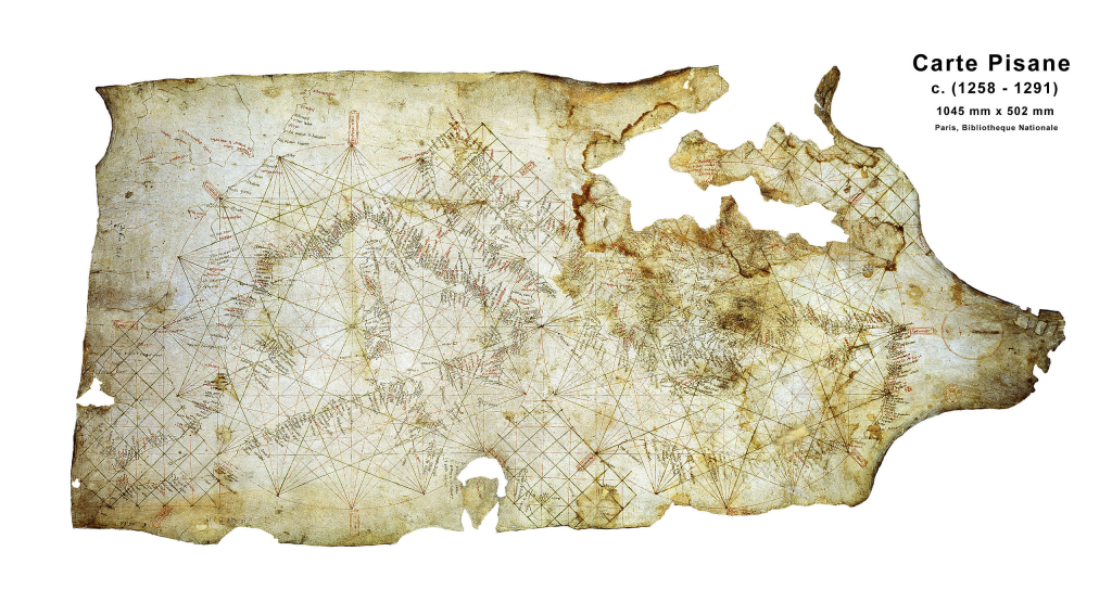
The history of sea maps and nautical cartography starts in the medieval period with the development of ‘portolan charts‘, which are some of the earliest known maps designed specifically for sailing. Portolan charts appeared in the late 13th century and were distinguished by detailed coastal outlines, compass roses, and networks of rhumb lines that helped sailors maintain bearings between city ports. The Carta Pisana (above), created around 1275–1300 and now preserved at the Bibliothèque nationale de France, is often cited as the oldest surviving map of this type, covering the Mediterranean and parts of the Atlantic with remarkable coastal detail for its time. (Pujades i Bataller, 2013)
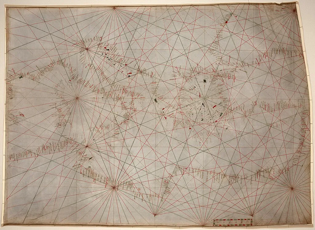
Portolan charts were usually drawn on animal skin and featured compass roses and straight lines that helped sailors keep a steady direction while at sea. These maps were not drawn to scale in a modern sense, but they were effective for navigation within familiar waters. Most early portolan charts came from Mediterranean regions such as Italy and Catalonia, where maritime trade was central to everyday life. As sea travel expanded beyond the Mediterranean, cartographers began adapting these maps to include new coastlines and routes, especially along the Atlantic Ocean and the African coast (Royal Museums Greenwich, 2023).
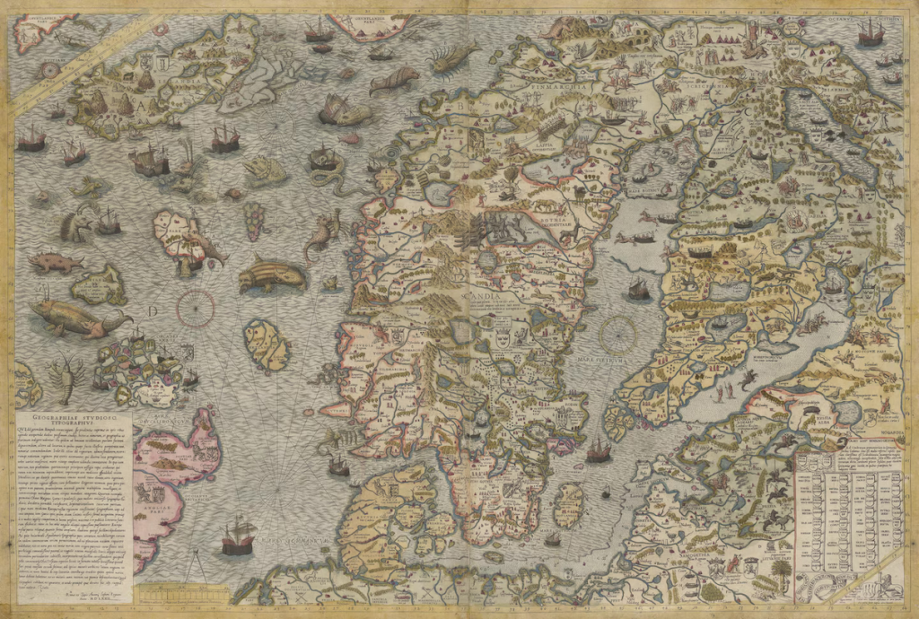
During the 15th and 16th centuries, sea maps began to change as European exploration increased. New discoveries meant that maps had to be updated regularly, and they often combined accurate coastlines with decorative elements such as ships, sea monsters, and mythical creatures. These illustrations reflected both limited knowledge of the oceans and the fears sailors had about unexplored waters. A key development during this period was Gerardus Mercator’s world map of 1569, which introduced a projection that made compass directions easier to follow. This projection became especially important for long-distance sea navigation and is still used in modified forms today (Royal Museums Greenwich, 2023).
By the 17th and 18th centuries, sea mapping became more organised and scientific. Governments began setting up official hydrographic offices to produce reliable charts for naval and commercial use. In Britain, the Admiralty’s Hydrographic Office was established in 1795 to improve the accuracy and consistency of nautical charts. This shift marked a move away from individual mapmakers towards standardised, state-produced maps, laying the groundwork for modern nautical cartography and eventually digital navigation systems (Lost Cartography, 2022).
Sea monsters began appearing on maps largely because of how little was known about the oceans at the time. For early sailors, vast areas of the sea were unmapped and unpredictable, and unusual sightings were often explained through imagination or existing folklore. Whales, giant squid, and other unfamiliar sea creatures were sometimes misidentified or exaggerated, especially when seen from a distance or during storms. These accounts were then passed on verbally or recorded in travel logs, which cartographers sometimes used when filling in unknown areas of their maps (Royal Museums Greenwich, 2023).

In many cases, sea monsters were added to maps to visually represent danger rather than to document real creatures. Areas that were difficult to navigate, prone to storms, or poorly understood were often decorated with large beasts, reinforcing the idea that these waters were risky or hostile. This was particularly common in the 15th and 16th centuries, when exploration was expanding faster than accurate surveying. Mapmakers used sea monsters as a way to communicate uncertainty, especially in regions far from familiar coastlines (British Library, 2021).
Sea monsters also served a decorative and symbolic purpose. Maps during this period were expensive objects, often commissioned by wealthy patrons or institutions, and visual detail was an important part of their value. Illustrations of sea creatures added drama and helped fill empty spaces on the map, particularly in open ocean areas where little geographical information was available. These creatures were often inspired by medieval bestiaries, mythology, and religious symbolism, blending real observations with fantasy (Pujades i Bataller, 2013).
As navigation and scientific understanding improved, the presence of sea monsters on maps gradually declined. By the 17th and 18th centuries, increased exploration and the rise of hydrographic offices led to more accurate charting of the seas. Decorative elements became less common as maps shifted towards a more functional and scientific purpose. While sea monsters largely disappeared from practical navigation charts, they remain an important part of cartographic history, offering insight into how people once understood and imagined the unknown ocean (Lost Cartography, 2022).
British Library (2021) Here be monsters: Sea creatures on medieval maps. Available at: https://www.bl.uk/picturing-places/articles/here-be-monsters (Accessed: 6 January 2026).
Lost Cartography (2022) The development of the nautical chart: Mapping the seas. Available at: https://lostcartography.com/the-development-of-the-nautical-chart-mapping-the-seas/ (Accessed: 6 January 2026).
Pujades i Bataller, R.J. (2013) The Pisana Chart. Really a primitive portolan chart made in the 13th Century? Comité Français de Cartographie, 216 (June), pp. 17–32
Royal Museums Greenwich (2023) Sea charts and maps. Available at: https://www.rmg.co.uk/collections/our-collections-sea-charts-maps (Accessed: 6 January 2026).
Leave a Reply